Valle delle Ferriere, Amalfi
Discover the stunning beauty of Valle delle Ferriere in Amalfi. Enjoy scenic hikes, breathtaking waterfalls, and rich biodiversity in this enchanting nature reserve. Perfect for outdoor enthusiasts and nature lovers, Valle delle Ferriere offers a unique glimpse into the Amalfi Coast's hidden gems
Valle delle Ferriere: la riserva naturale statale
The Valle delle Ferriere in Amalfi is a unique place, located in a special position between the Lattari Mountains of Scala, which protect it from cold winds while being open to the warm, humid southern currents. As a result, it experiences abundant rainfall, boasting physical and biological characteristics that have allowed for the preservation of ancient plant species. In this extraordinary natural environment, there are species dating back to the Tertiary geological era, such as thermophilic plants and, most notably, the giant fern Woodwardia radicans, first identified by the botanist Pier Antonio Micheli in 1710. This is a very rare testament to the pre-glacial flora of Italy, which can only be found here and in some areas of the Vallone Porto di Positano, where the humidity is sufficient to meet their needs. Additionally, among the rich flora, we can also mention Pteris cretica, Pteris vittata, and the carnivorous plant Pinguicula hirtiflora.
The valley is also home to many animal species. Here, you can find the spotted salamander, an urodela belonging to the Salamandridae family, the common toad, the peregrine falcon, and the great spotted woodpecker.
Thus, the entire ecosystem represents something unique, with invaluable scientific and naturalistic value.

The Trekking Route in the Valle delle Ferriere
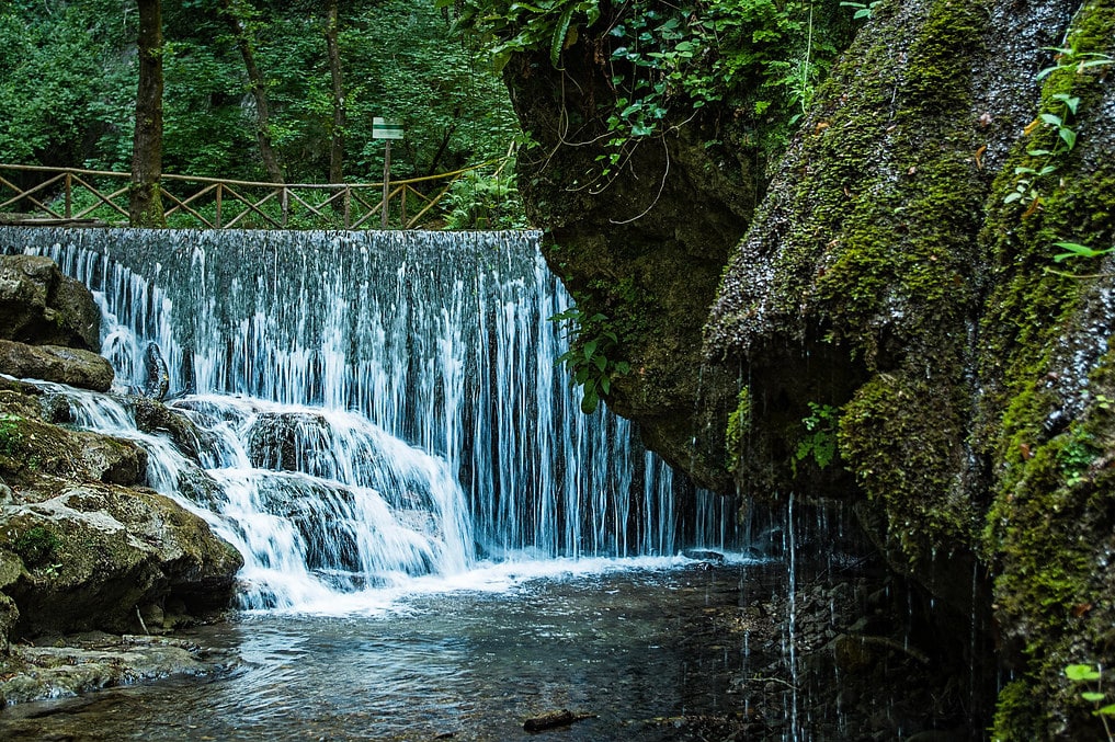
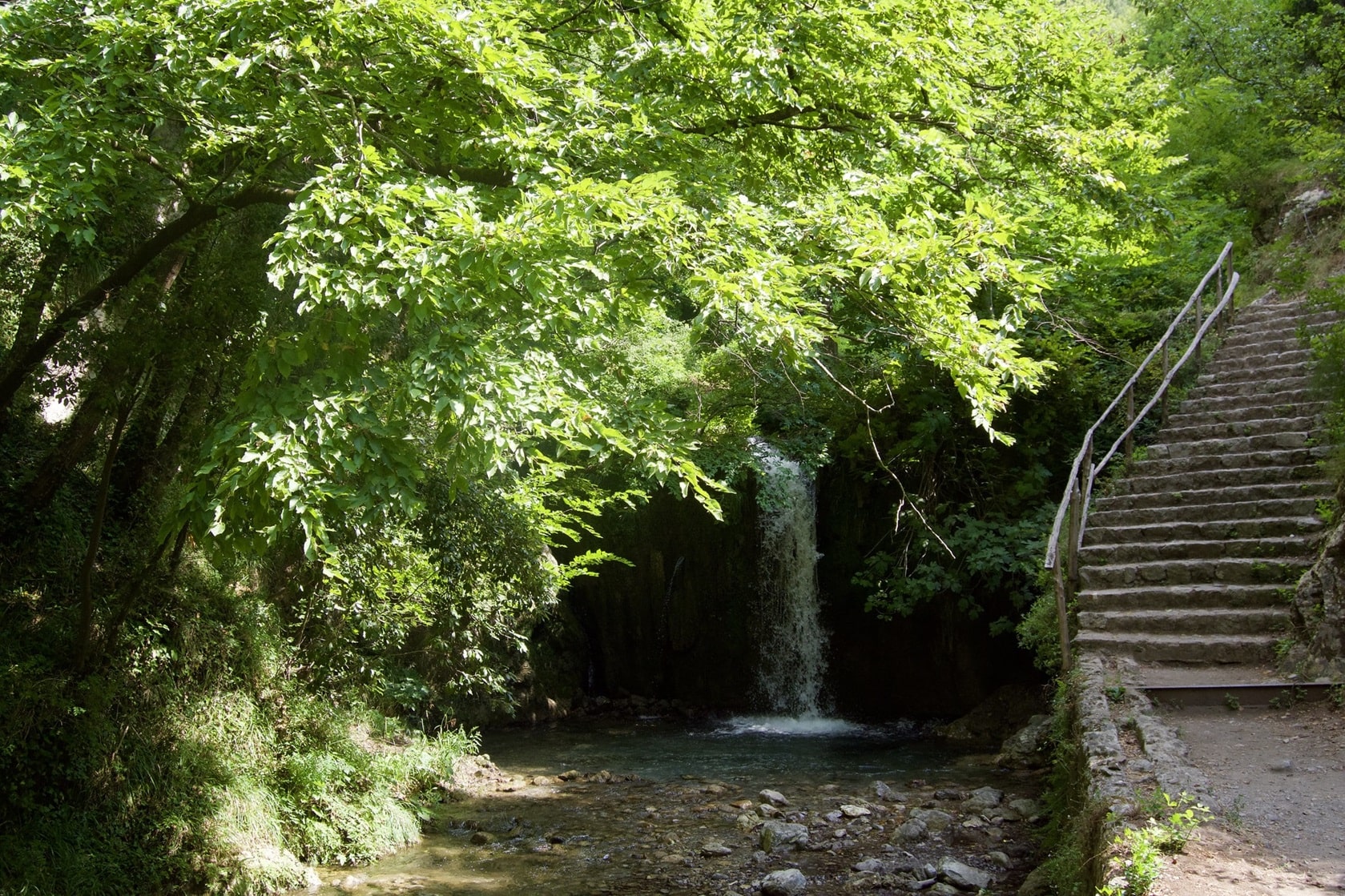
The Valle delle Ferriere is a perfect place for trekking, capable of surprising both casual tourists and hiking enthusiasts, all thanks to the beauty of its vegetation and the refreshing cascades and streams that traverse it, especially in the height of summer.
The trail system in the area allows you to traverse the entire valley via 2 main routes, traditionally referred to as the lower trail and the upper trail.
The most interesting part of the valley is undoubtedly the nature reserve, located at its center.
The trekking route through the Valle delle Ferriere is quite simple and suitable for everyone, covering a distance of about 8 km, which can be completed in 4 hours, starting from Pontone (a fraction of Scala) and returning to Amalfi.
Departure from Pontone
The starting point in Pontone for the trekking route (trail no. 323a) towards the Valle delle Ferriere is located in Piazza San Giovanni. The village of Pontone, a fraction of Scala, is situated 225 meters above sea level and is accessible from Amalfi or Ravello by the SITA bus, which connects the cities of Amalfi, Ravello, and Scala.
From Pontone, starting from the square, take the gently rising path behind the fountain and follow the mule track along the main route, keeping the steep stairs on your right. After about 200 meters, you will find a staircase leading directly to Amalfi (useful for returning to Amalfi) and a path that leads into the valley. Continue along the trail, which winds through woods, streams, and waterfalls, until you reach an aqueduct. After this, you will arrive at the first ironworks and the Canneto stream, which was used as the driving force for the mills of the ancient paper factories in Amalfi. The route ends at the junction with trail 325.
Departure from Amalfi
The starting point in Amalfi for the trekking route (trail no. 325) towards the Valle delle Ferriere is located in Piazza Flavio Gioia, which is the terminal for SITA buses coming from Salerno and Sorrento, as well as for ferries. From Piazza Flavio Gioia, head to Piazza Duomo, where the Amalfi Cathedral stands, and then continue along the main street of Amalfi until you reach the Valle dei Mulini and the Paper Museum of Amalfi. Once here, continue to the right and take a staircase on the left that ascends for about 200 meters, passing through lemon groves, several ancient paper mills, and the ruins of the Ironworks, where iron was extracted from the stones. From here, you can proceed by following the signs for the trail that starts from Pontone.

Departure from Agerola
If you are starting from Agerola, it's good to know that the trekking route to the Valle delle Ferriere is of mild difficulty and lasts about 3 hours, with an elevation change of 500 meters downhill and 250 meters uphill. From the starting point, located at 630 meters above sea level, follow the direction of Castello Lauritano and the trail to Monte Murillo (849 m.), continuing toward the Valle dei Mulini.
How to Reach the Valle delle Ferriere
For those coming from Salerno, you can exit the A3 motorway at Vietri sul Mare and then take the SS163 Amalfitana road to Amalfi or reach Pontone.
For those coming from Naples via the A3, take the Angri exit, continue in the direction of Ravello, and then reach Amalfi or Pontone.
Valle delle Ferriere: where to park
In Amalfi, you can park your car right near the beginning of the trail in the blue-striped parking lot, just a few meters from the beach, with a cost of about €2.50/hour. Please note that parking spots are limited.


